Photo Travelogue :
Read first part - Here!
Although, the highways to reach Shillong from Guwahati are smooth and wide, being a city in the hills, the roads get considerably narrower towards, and in the the city itself. As such. lanes are often crowded with traffic. For instance, from Umiam Lake our pace slowed down to almost that of a snail's to reach the city center. However, its an experience in itself and I found Shillong to be a cute little hill-station. Being near to Ghy, I wouldn't mind going there again. Some City Shots!

the bridge cum road that goes to Upper Shillong...

the busy city outskirts, just before entering main city...


some directions around the city, military hospital, traffic point, air force ground...

the circle opposite Shillong Centre Point, decorated due to Christmas...


the crowded main city Centre Point, Shillong, connected by various lanes...
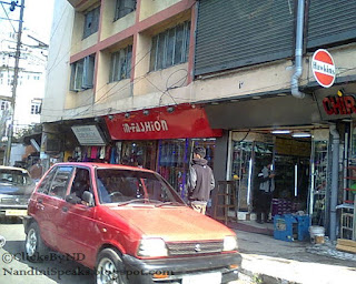
market area...near the the centre point...

a random traffic circle...

shillong traffic...due to narrow roads it gets conjested in no time...

shillong roads in the evening time...bumper to bumper...


encountered some more traffic as we start leaving the city...

bye bye Shillong...
Shillong is a hill station in northeast India and capital of the state of Meghalaya. It’s known for the manicured gardens at Lady Hydari Park. Nearby, Ward’s Lake for its walking trails. North, the Don Bosco Centre for Indigenous Cultures features displays on the region’s native people. Waterfalls include the Elephant Falls to the southwest. East of here, forested Shillong Peak offers city views.
Meghalaya or "the abode of clouds" in Sanskrit, is a hilly state in northeastern India ( wiki ).
Address : Shillong, Meghalaya
Stay tuned for all my road, rail, flight, cruise & walk trips.
( Images - ©Mine. All rights reserved. )
Our Rating Scale is : 1 to 5 = ◕◕◕◕◕ - It was Awesome!

No comments:
Post a Comment