Showing posts with label Meghalaya. Show all posts

DAY TRIP DEEP INTO MEGHALAYA FORESTS VIA RANI


Photo Travelogue :


Meghalaya, a northeastern state lies to the south of Guwahati, Assam and there are multiple ways to go there. Its one of the most beautiful places to visit in India...with raw untouched beauty. The GS road or NH 40 that starts from Jorabat ( in outskirts of Guwahati ) splitting into two - one going shillong and the other to Dawki ( near India-Bangladesh border ) is the most common route. However, there are other routes which are less travelled and less crowded. They are more scenic and adds to the fun and adventure. I love roads that passes through forests; and whenever I come to know about some I just have to be on that road. So, I heard about this alternate road going into Meghalaya...I just had to try it. I didn't want to go all the way to shillong...but, just ride couple of hours...enjoy and come back. Interestingly, this road passes through a thick forect ( Deciduous and Evergreen Tropical Forests ) and my excitement knew no bounds. I sped to the location and it was just a thrilling time I had. I simply loved being one with nature. Here's my trip in pics. Enjoy :-)

NONGRIM JIRANG MEGHALAYA
those hills are beckoning....

NONGRIM JIRANG MEGHALAYA
the entire road they give company...

NONGRIM JIRANG MEGHALAYANONGRIM JIRANG MEGHALAYA
village roads...and it begins to rain...oh no!

determined, I move ahead...rain not gonna stop me, cos' I have the raincoat...lol...
NONGRIM JIRANG MEGHALAYA
passing by the rani forest office...

NONGRIM JIRANG MEGHALAYA

NONGRIM JIRANG MEGHALAYANONGRIM JIRANG MEGHALAYA
the sal forests begins ...plenty of those on the way...

passing by beautiful hills and fields...
NONGRIM JIRANG MEGHALAYANONGRIM JIRANG MEGHALAYANONGRIM JIRANG MEGHALAYANONGRIM JIRANG MEGHALAYANONGRIM JIRANG MEGHALAYA

NONGRIM JIRANG MEGHALAYA
am quite envious of the people who live here and see this view everyday of their lives...

NONGRIM JIRANG MEGHALAYA
and, the ride continues...hello bakri ( goat )...are you gonna gimme company?

NONGRIM JIRANG MEGHALAYA
the bakri vanishes and I'm alone on the road once again...

NONGRIM JIRANG MEGHALAYA
more sal trees come up...

NONGRIM JIRANG MEGHALAYA
the sign at corner of a fork says Chandubi 23 kms ( right ) and ahead is Meghalaya...

NONGRIM JIRANG MEGHALAYA
the road to Chandubi...in the rain it looks quite narrow and spooky...

NONGRIM JIRANG MEGHALAYA
moi, deciding which way to go ahead...hmmm...

NONGRIM JIRANG MEGHALAYA
chalo Meghalaya...

NONGRIM JIRANG MEGHALAYA

NONGRIM JIRANG MEGHALAYANONGRIM JIRANG MEGHALAYANONGRIM JIRANG MEGHALAYANONGRIM JIRANG MEGHALAYA

NONGRIM JIRANG MEGHALAYA
sal trees are so disciplined...they stand tall; in perfect lines, and, in-attention!

I went pretty deep about almost two hours ride into Meghalaya. It was all green forests every where...it was drizzing too and there was no one in the rain soaked road except me...oh how I loved it...just pecfect... me and nature!
NONGRIM JIRANG MEGHALAYANONGRIM JIRANG MEGHALAYA
sadly, time to speed back home...

With reluctance I had to turn back.as it was getting quite late and dark. There are no street lights in these forest roads and driving around alone after dark gets bit scary too ( not recommended ). But I totally loved it...and am going to be back someday soon.


Meghalaya's forests are rich in biodiversity, endemism, and forest cover. They are also a source of clean air, water, and livelihood. Meghalaya translating to 'abode of clouds' has some of the highest rainfall regions in this world.
Address : Jirang Nongrim Road, Meghalaya.
Read next part - Here! Stay tuned for all my road, rail, flight, cruise & walk trips.
( Images - ©Mine. All rights reserved. )
Our Rating Scale is : 1 to 5 = ◕◕◕◕◕ - It was Awesome!

SHILLONG CITY IN PICTURES - DAY TIME


Photo Travelogue :
Read first part - Here!

Although, the highways to reach Shillong from Guwahati are smooth and wide, being a city in the hills, the roads get considerably narrower towards, and in the the city itself. As such. lanes are often crowded with traffic. For instance, from Umiam Lake our pace slowed down to almost that of a snail's to reach the city center. However, its an experience in itself and I found Shillong to be a cute little hill-station. Being near to Ghy, I wouldn't mind going there again. Some City Shots!

SHILLONG CITY
the bridge cum road that goes to Upper Shillong...

SHILLONG CITY
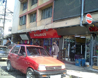
the busy city outskirts, just before entering main city...

SHILLONG CITYSHILLONG CITYSHILLONG CITYSHILLONG CITY
some directions around the city, military hospital, traffic point, air force ground...

SHILLONG CITY
the circle opposite Shillong Centre Point, decorated due to Christmas...

SHILLONG CITYSHILLONG CITY
the crowded main city Centre Point, Shillong, connected by various lanes...

SHILLONG CITY
market area...near the the centre point...

SHILLONG CITY
a random traffic circle...

SHILLONG CITY
shillong traffic...due to narrow roads it gets conjested in no time...

SHILLONG CITY
shillong roads in the evening time...bumper to bumper...

SHILLONG CITYSHILLONG CITYSHILLONG CITYSHILLONG CITY
encountered some more traffic as we start leaving the city...

SHILLONG CITY
bye bye Shillong...


Shillong is a hill station in northeast India and capital of the state of Meghalaya. It’s known for the manicured gardens at Lady Hydari Park. Nearby, Ward’s Lake for its walking trails. North, the Don Bosco Centre for Indigenous Cultures features displays on the region’s native people. Waterfalls include the Elephant Falls to the southwest. East of here, forested Shillong Peak offers city views.
Meghalaya or "the abode of clouds" in Sanskrit, is a hilly state in northeastern India ( wiki ).


Address : Shillong, Meghalaya
Stay tuned for all my road, rail, flight, cruise & walk trips.
( Images - ©Mine. All rights reserved. )
Our Rating Scale is : 1 to 5 = ◕◕◕◕◕ - It was Awesome!


Related Posts Plugin for WordPress, Blogger...

VISITING THE UMIAM LAKE BY ROAD, BARAPANI, MEGHALAYA


Photo Travelogue :
Read first part - Here!

It took about 40minutes ( due to traffic ), to reach Umiam/Barapani lake from Shillong. I caught its views while returning to Guwahati. Since it was the month of December, it gets dark quite early!

UMIAM LAKE, BARAPANI, MEGHALAYA
this sign, since we are visiting the Lake while leaving Shillong...

UMIAM LAKE, BARAPANI, MEGHALAYA
the bridge over the lake that we cross while going to and fro Shillong, from Ghy...

UMIAM LAKE, BARAPANI, MEGHALAYA
looking over the bridge...it was getting cloudy...

UMIAM LAKE, BARAPANI, MEGHALAYA
view from edge of the bridge...

UMIAM LAKE, BARAPANI, MEGHALAYA
surrounded by green hills, its beautiful...

UMIAM LAKE, BARAPANI, MEGHALAYAUMIAM LAKE, BARAPANI, MEGHALAYA
with the day-lights getting dimmer, this is all I cloud manage to click :-)
( there are other view-points in the hills near by, to get bird's eye view of the lake )

UMIAM LAKE, BARAPANI, MEGHALAYA
the lake, peeping from behind the small road-side paan shops...

UMIAM LAKE, BARAPANI, MEGHALAYAUMIAM LAKE, BARAPANI, MEGHALAYA
other tourists too had got down to view the lake and click selfies around it...


Umiam Lake ( commonly known as Barapani Lake ) is a reservoir in the hills 15 km (9.3 mi) north of Shillong in the state of Meghalaya. The lake serves as a major tourist attraction for the state of Meghalaya. It is also a popular destination for water sport and adventure facilities. Tourists visit this spot for kayaking, water cycling, scooting, and boating.
Meghalaya or "the abode of clouds" in Sanskrit, is a hilly state in northeastern India ( wiki ).


Address : Umiam Lake, Ri Bhoi District, Nongpoh, Meghalaya
Read next part - Here! Stay tuned for all my road, rail, flight, cruise & walk trips.
( Images - ©Mine. All rights reserved. )
Our Rating Scale is : 1 to 5 = ◕◕◕◕◕ - It was Awesome!


Related Posts Plugin for WordPress, Blogger...